Bikepacking the old Tibet road to Chitkul – October 2019

Sometimes a journey arises out of hope and instinct, the heady conviction, as your finger travels along the map.’
—Colin Thubron
The Old Hindustan–Tibet Road is the last original romantic mountain road eulogized by the intrepid traveller and adventurer Colin Thubron and was classified by the History Channel as one of the deadliest roads in the world. Built in the 1850s by Lord Dalhousie to facilitate trade with Tibet and consolidate commercial and strategic interests in the region, the road has often been referred to as the offshoot to the Silk Route. Traders from across the Tibetan plateau would travel on yaks to trade with the nomadic settlers across the higher passes of the Himalaya and also engage with the Bushahr kingdom, a former princely state located in the western Himalaya bordering Tibet.

The ride to pretty Rakchham and then Chitkul, in Kinnaur on this famous route is the kind of adventure hundreds of adventure enthusiasts undertake on motorbikes and other vehicles but few by solo, self-supported cyclists. Chitkul is at the edge of the Indo-Tibetan border, at an altitude of 3,450 m/11,320 ft.
The route I had planned was Narkanda–Jeori–Sarahan–Bhawanagar–Sangla–Rakchham–Chitkul, a distance of 210 km and a mind-numbing 15,000 m/49,252 ft of elevation gain in just four cycling days. When I was planning my trip, I was unaware of this, as the data was just not available anywhere.
The days of supported expeditions were long over for me. I had evolved both temperamentally and in confidence and definitely in skill to survive on my own, having done that for well over a year and a half on the pan-American highway from the Arctic to the Andes. From a full pannier set-up with a two-man tent and handlebar bag for my long odyssey in the Americas, I decided to move into a tighter bikepacking set-up. Bikepacking is a form of bicycle touring but with more compact, lighter and minimalistic gear bags to enable faster coverage of ground and facilitate longer distances over tough terrain. The quantum of gear that a cyclist carries is dramatically reduced by as much as 60%. The gear carried is multi-use, usually ultralight, durable, highly efficient and packable. So, a down jacket could be rated as 850 down but when packed would fit into a pocket. An ultralight sleeping bag that can withstand upto -5 degrees Celsius would be a fraction of the size and 50% of the weight of a regular one.

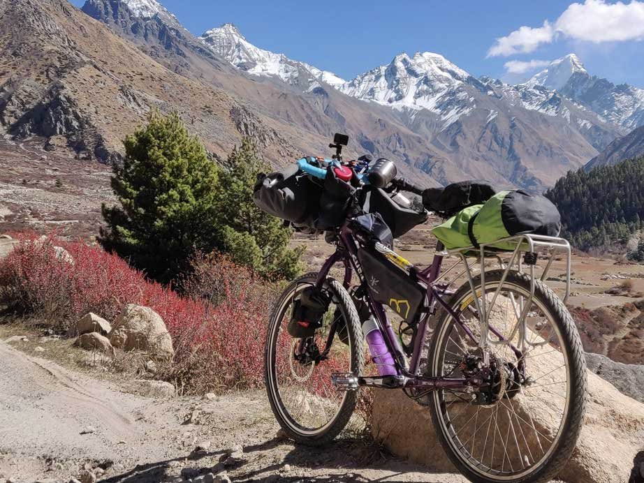
The morning of day one of the four-day expedition to Chitkul was bitterly cold. The air sliced through my gloves and froze my face and ears. The road from Narkanda to Rampur is 62 km of all tarmac and 2,600 m/8,530 ft of pure, joyful descent for about 30 km with a gradual climb after that. The chilly mountain air smacked right into me even as I turned corners and rumbled over broken sections of the roads, weaving my way down the mountain from 2,743 m/9,000 ft to the valley below, riding fast along the river Sutlej. From the corner of my eye, I was able to spot many birds, a Khalij pheasant scurrying across the road, yellow-billed long tailed magpies flying from one tree to the other and the evasive Blue Whistling Thrush. I stopped a couple of times and spent precious minutes treading softly to photograph them. The conifer, oak, maple and poplar trees towered above me and I even saw some majestic griffins, the stately Himalayan vultures, sunning themselves in the early morning sun and letting the warmth dry their wings from the moisture of the night. I rattled and clinked down the bumpy road, taking hairpin bends with ease, negotiating the potholes and oncoming traffic. The dry bag strapped onto the rear rack of the Surly was packed frugally with a down jacket, rainproof jacket and pants, merino base layers, woollen socks, some dry food and a medical kit. The expedition frame pack which is mounted below the top tube, contained the tool kit, spare tube, headlamp, a knife, energy bars, a small air pump and other miscellaneous items. The handlebar bag was stuffed with my sleeping bag and the thermal liner, cameras and charging cables.
With the evening light dimming and my energy hitting a wall after over 70 km of riding in the mountains on day one, I chose to take a ride in an empty mini-truck that was returning after having transported apples. It was headed to Sarahan, 12 km away at an altitude of 2,100 m/7,000 ft. I loaded the cycle on the top of the vehicle and rumbled up the mountain as it was quite a rocky road. The air in Sarahan was very cold, it was towards the end of October and the temperature plummeted to 2 degrees Celsius. Clouds had begun to assemble earlier in the evening and the mountain was showered by some chilly rain during the night. I was left wondering how I would cycle the following day If it was still raining. Sarahan is a small village but it is the site of an ancient heritage temple, dedicated to the goddess Bhimakali, the deity of the former rulers of the region, the Bushahr dynasty.


The plan for day two was to get to Bhawanagar. Though just 37 km away, the elevation gain was more than 1,500 m/5,000 feet. Between Jeori and Karcham, the site of the Wangtoo Hydroelectric Plant, there did not seem to be any homestay or small hotel where I could spend the night. On the OsmAnd+ app—that I was using to map the journey—there did appear to be some place to stay in Bhawanagar but I could not be sure, so the next village, Tapri, was my backup plan. There was a Public Works Department (PWD) rest house there. Since I was not carrying a tent on this trip these decisions had to be taken. The downhill ride from Sarahan to Jeori was bone-rattling and cold, but with some great views of the mountains. Upon reaching Jeori, I did not stop and pedalled furiously up a suddenly steep climb as the mountain road rose again.
I rode with a heavy heart for a long time, climbing and descending the roads of the Old Hindustan–Tibet route. It was after a long time that I was able to focus on my journey again. The road was well paved in some sections but broken and rocky in some, the sun bearing down harshly, making the ride even harder. Thankfully after 2 p.m., the sun moved west and hid behind the mountain as it curved. The road turned chilly again, the river Sutlej sparkled a lovely aqua green in the sunlight, a few thousand feet below me. This was a narrow and steep gorge and the road cut through the mountains. In this section of the journey, the mountains were thinly forested and were drier than the verdant conifer forests of the Narkanda region.

I reached the signboard welcoming me to Kinnaur. It is one of the most beautiful districts in the country, flanked by three great mountain ranges—Zanskar, Great Himalayan range and the Dhauladhar—their valleys fed by some of the most powerful rivers, the Sutlej, the Baspa and the Spiti. It is a land where the worlds of Buddhism and Hinduism meet and mingle.
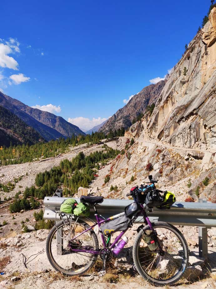
I reached a point near Nigulsari. Here the road was paved and cut incredibly into the rock with massive overhangs of jagged stone. I had seen many videos of this famous section of the road but now the epic section of the Old Hindustan–Tibet Road opened its jaws to an awe-inspiring canvas. The deep gorge to the left dropped a few thousand feet and I stopped at the edge, lingering on, to soak in the dangerous drop and the marvellous landscape. The thrill of cycling another dangerous road in the world was just as exciting as it was daunting.
This road must be one of the finest feats of the BRO. It is an engineering marvel built in 1962 after the disastrous Indo-China war to facilitate rapid movement of troops and equipment to the border. At the beginning of the section of this road, I came across a temple right at the edge of the cliff. It is named the Maa Taranda Temple and I observed that it was maintained by the army.
Bhawanagar is a small trading town, built on the back of the Wangtoo Dam, and when I entered it in the late afternoon it was bristling with activity. The sun was shining on the homes on the upper reaches of the mountain while the town itself lay shrouded in the shadow. It seemed to have a busy, noisy air about it like all small hill towns. There were a few fruit and vegetable vendors, a couple of smoky dhabas, a busy bus stand and clusters of men, women and children sitting on the road, waiting patiently. There was only one homestay here, right on top of the mountainside, teeming with dirty and dusty shanty rooms, homes and small kirana stores with only steps to reach them. There was no path. Fortunately, I had some help from the boy from the homestay to carry some pieces of my gear while I hauled the bike on my shoulders on the steep steps for almost 10 minutes.
This was day three and promised to be an exciting one, as the distance to Sangla and then Rakchham was a doable 59 km, but the elevation gain for the day was 3,643 m/11,952 ft. Rakchham is a small village of nomads about 13 km ahead of Sangla and Dhananjay had recommended highly that I halt there before proceeding to Chitkul, emphasizing that it was really pretty. I was motivated by the thought of being surrounded by pastoral lands, forest and pristine mountains and that fuelled my intensity.
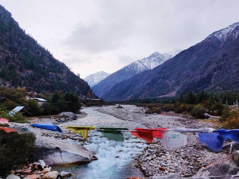
It was a bright and sunny day, with astonishing clear deep blue skies. The climb was gradual to start with and the air was crisp and cool. By noon, after cycling past some gorgeous sights, and a little before Chooling, I crossed an army Bailey bridge with Buddhist prayer flags adorning it.
The road to Sangla narrowed significantly after a couple of kilometres to a width of just 3.5–4.5 m/12–15 ft, barely enough for two vehicles to squeeze past each other. The most nerve-wracking sight was to watch two Himachal Road Transport buses cross each other on the road, one of them lingering precariously on the edge with a wheel hanging coolly in mid-air, even as the other one grazed past the rockface on the mountainside. This is however quite a normal sight in the high mountains but whenever I do see it, I am filled with wonder at the skills of the drivers and the silent courage and nerve of the passengers.
As I began to reach 2,438 m/8,000 ft to 2,743 m/9,000 ft the views got prettier and the autumn colours thrilled the heart. I could see thick forests of oak, fir and poplar sprinkled with a gorgeous medley of colours of green, auburn, pale yellow and rusty red leaves. Looming overhead in the horizon stood magnificent snowy peaks. Late in the evening I finally entered the Tibetan Gate welcoming the much-awed-by-now traveller to Tupka valley.
The guest house in Rakchham where I stayed was Rupin River View, a modest but comfortable lodging overlooking the village of Rakchham. It was a steep climb to the lodging perched a bit above the road and I was gasping for air as I lugged my bicycle and gear. I was the only one staying there and I was able to get a hot meal quite quickly. The room had wooden flooring and thick blankets on the bed but I always preferred my sleeping bag as it was very cold and there was no heater.
The early morning light crept into the room through the maroon-coloured curtains. I staggered out of my sleeping bag to the window to peep outside as it had been too dark to see my surroundings, the previous night. The first sight made me gasp, as I looked directly at a massive snow-covered range of peaks looming over the village. I looked around and I realized that the village was in a really narrow valley dominated by the Baspa river and its banks that fertilized the fields. On either side, rising up towards the sky were mountain citadels. To the east of Rakchham lay a massive vertical rockface called the Shoshala Peak that the guest house staff said was home to many of the best rock climbers.
I was excited to be in this pretty village flanked by epic mountains and as I hauled my bicycle to the road for Chitkul, 12 km away, I was filled with a sense of accomplishment, as reaching here on my own power had been a dream. I was now on the final leg of the famous Old Hindustan–Tibet Road journey. The road to Chitkul was narrow and paved for the initial two to three kilometres and I passed beautiful forests and gentle meadows, my bicycle wheels winding past thick groves, grassy patches and incredible views. As I ascended in altitude to 3,352 m/11,000 ft, the road got rougher and narrower with no barriers on the precarious edges. The forests were a delightful orchestra of colour and offered an immersion in solitude with abundant nature. The road elevation continued to rise for an hour and then the steepness of the grade dropped and allowed me to cycle more easily.
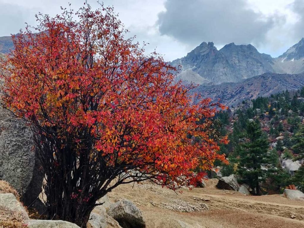
In some sections, the road was so tiny that it blended with the mountains itself in the distance. It was quiet and there was no traffic at all, not even a thundering motorcycle out on an expedition. At close to noon, I reached the signboard that proudly proclaimed that I was at Chitkul, the last Indian village on the Old Hindustan–Tibet Road at 3,450 m/11,320 ft. The views were astounding. Massive peaks rose into the air like sphinxes, their majestic pinnacled peaks thrusting into the sky. Dense red shrubs lined the road and lent the stony, sand-coloured and rugged landscape a highlight colour!
Once upon a time, Chitkul village would have been a quaint and authentic outpost, deep in the Himalaya. The evidence of that still exists in the form of older and more traditional wooden homes and temples. The wooden homes are built on stilts with the main living quarters on top and the lower half used for the livestock and their feed. Yaks and mules are still used to ferry materials and for ploughing. The push for tourism has ensured that the village is overrun by tourists from all over India each summer.
Traversing the Old Hindustan–Tibet Road on a bicycle signalled the completion of another soul journey in the Himalaya. Adventures in the mountains keep revealing mythical colours and stories about themselves. The beliefs and values of the mountain folk and culture are deeply embedded in Hinduism and Buddhism and it is in these remote places that we begin to see how finely and intricately the two are intertwined.